Our Book - "Peaks of the East"

Our Book - Only $10 Each!
Unbelievable! We actually did it! Spanky and I have written and published a book entitled "Peaks of the East." Amusing and entertaining chronicles of all our summits to date - 24 of em - hell thats half the lower 48. Please click on Peaks of the East for details.
Actual Reader Comments:
- I just finished reading your book last night - it is wonderful! It brought me back to reminiscing about my childhood, the simple life, and enjoying nature.
- A very enjoyable read.
- The book is timely and hits the right chords with a lot of us.
- Your book rocks!!
- We are living vicariously through you and Spanky.
- Loved the book!
- Finished the book this past week - a great romp!
- It's great! I'm loving it!
- Reading the book, I feel like you are talking directly to me telling me your stories.
- Your love for Spanky comes through on every page.
- Reminds me a lot of Andy Rooney or maybe Bill Bryson.

Meet Spanky

Hi everyone! My name is Spanky. As you can see, I'm a dog! I live with this dude named Rein Krevald (Weird name isn't it? he is Estonian - more on that later). The two of us are creating this blog to share our mountain climbing adventures with you. We are traveling around the country in our Dodge Ram pickup, hitting the summit of each state, and reporting our escapades to you. Hope you enjoy it. We sure as hell do! Arrrrrrrrrrrrrrrrf!

Spanky

PS You can click on "comments" below each post to add a little feedback. A little note on organization of our posts - we are posting our most recent updates last - the intent being that this reads more like a book - intro first, then our intitial summits etc. So go to the Table of Contents on the right to select the post/chapter you want to look at. And........if you want to see some great pics, click on "Spanky & Rein's Web Album" in the links list to the right of this post. Lastly, if you'd like to email us, our email address is rkrevald@gmail.com

What Is This All About?

My name is Rein Krevald - I'm the "dude" that Spanky (the canine team member) lives with. As Spanky already mentioned, the two of us have decided to travel around the US and hit the highest point in each state. It will be the first Canine, Human team to attempt such a feat. This blog will serve as a quick update of our activities. However..........it is rumored that a book deal is on it's way. So please follow us on our adventure, have fun reading this crap, and most importantly, buy the book when it comes out - we NEED the money!

The Top of Florida

January 28th & 29th, 2007
You are probably thinking, "Does Florida have any mountains?" The answer is an unequivocal no! The highest point in Florida is a place called Britton Hill. It tops out at 345 feet. That my friends is why Spanky and I picked it for our first summit attempt! We figured that we had a pretty damned high probability of success.

Britton Hill is located in NW Florida on the panhandle. It is actually in the Central Time Zone (most of FL is Eastern), about 25 miles north of DeFuniak Springs (look at a map if you are really interested), a few miles south of the Florida/Alabama border.

Me and Spanky bivouacked in a Gulf Of Mexico beachfront Motel 6 the night before our assault on Britton Hill. Our climb started just before dawn. We began from all the way down at sea level so we wanted to be sure not to rush things for fear of getting altitude sickness (pulmonary edema). Thus we took it easy on the 60 or so mile drive from the beach to Britton Hill. It was a beautiful sunny day but bitter cold (28 F)...........which did not bother us cause the heater in the truck worked just fine. I drank coffee, checked out the Florida countryside while Spanky slept in the passenger seat. By the way, Crestview, FL has a lot of guys that still sport mullet hairdos and wear camouflage. What's up with that?

At approximately 9:03 a.m., CT, Spanky set his paws, and I my feet, on the lofty summit of Britton Hill. Oh yeah, since Spanky and I are such seasoned climbers, we did not find supplemental O2 to be necessary. We caught our breath, grateful to be alive, and took in the view. Spanky immediately did what he does best when he is outdoors, he ran around in circles at full tilt. We played fetch the stick, Spanky and I both took care of some personal hygiene type stuff, and then we got down to business.

We had to do the mountain climber, adventurer thing. I retrieved my hand held Garmin GPS and verified the Latitude/Longitude and elevation. We had come so far and wanted to make sure that were in fact at the summit of Britton Hill. Next came out the camera (Nikon Coolpix) in order to document this feat of mountaineering. Now that I mentioned cameras, considering the pre climb media interest in this first ever canine/human assault on Britton Hill, there was in fact, no one there? I guess they were all busy with that Iraq thing or maybe the elections.

The first pic is me and Spanky on the summit next to the monument dedicated to all the fallen climbers that did not make it to the top. Next is the Walton County sign which marks this as Florida's highest point. Followed by a breathtaking summit view into the valley. Last but not least, Spanky on the beach.

Just to let you know. This is the first time I'm trying this blog thing. Hopefully I'll get better at arranging pictures and captions.


To see all the pics related to this post, go to http://picasaweb.google.com/rkrevald/FloridaSummit

Expedition Logistics and Planning

Having successfully accomplished our first summit, Spanky and I returned home with a freshly renewed confidence and the fortitude to go on with our seemingly unattainable goal. Our enthusiasm was also buoyed by the amazing response and feedback that we got from our initial blog post. With comments like, “You are insane! I wish I was you”, “You guys are absolutely nuts”, how could we not go on.

We quickly realized that we can’t just go rushing off like a couple of chickens with our heads cut off. There was a lot of planning and preparation to be done. Not to mention the logistical nightmare that faced us. A daunting task, you’d have to agree!
Just like Sir Edmund Hillary, Columbus, Lewis and Clark, Roald Amundsen, Ernest Shackleton, and Bluto Blutarsky before us, we understood that only fastidious preparation is acceptable for an endeavor of this magnitude. It could easily make the difference between success and serious injury or even death.

Exactly where are the 50 summits? In what sequence do we tackle them? What shall be our route? How do we travel to these far away places? What about food and lodging? The list goes on.

Spanky and I broke out the ’07 Rand McNally road atlas, we scoured through Google Earth, we picked our way trough Microsoft Streets and Trips, we ran innumerable internet searches, and we consulted several cartographers that were referred to us. We compiled all our data into a custom developed Spanky and Rein data base. We ran an extremely complex linear programming model (borrowed from some friends at NASA) against the data and voila! The plan started to take shape.


Spanky Checks Computer Model Data


The answer was obvious, we would start with about a 3 – 4 week trip and hit Louisiana, Arkansas, Mississippi, Alabama and Georgia. Actually there isn’t a hell of a lot of logic there other than that these states are close, their summits aren’t that high, and most importantly, we have friends to freeload off of along the way!

There really has been a bit of preparation that we had to do. My truck, a white 1998 Dodge Ram 2500 4wd pickup, has 190,000 miles on it (all personally driven). A wee bit of maintenance (new tires, rear axle seal, new plugs, etc) was required to make it just a little more road worthy. We also decided, at least for now, to use my 1999 Predator Eagle (a local outfit) 6 x 12 cargo trailer as mobile expedition headquarters and for on the road lodging. Simple enough, I had a couple of windows and a skylight/roof vent installed and it was ready.


The Dodge and Our Modest Travel Trailer


Other than that, we did have to get our gear together. Spanky went to PetSmart, his preferred expedition outfitter to look for a doggy back pack, stock up on his favorite dog food (Purina ProPlan), dog treats, rawhides, and as always, to sniff around the other dogs that were busy shopping. We bought a new camp stove, got together other camping stuff like a cot, sleeping bag, camp cookware, blah, blah, blah. The list goes on.

My godson from Toronto Canada, Allan Marley, (my cousin Kati’s son), world renowned mountaineer, skier, and adventurer, is visiting me and Spanky for a few days. He will be providing us with some last minute pointers, spiritual guidance, and moral support. We are probably going to actually head out of here on or about February 26th. It may take a week or so (hopefully less) until we get a good internet connection and file an update. Please, don’t worry about us! I know you will all be waiting breathlessly to read our next update. We’ll keep ya posted as soon and as often as possible.

Thanks for tuning in!

On The Road Again

Well we’re on the road again. After much running around in circles (me not Spanky) like a chicken with my head cut off, I finally got all the gear packed and stowed, took care of stupid stuff like bills, had the mail forwarded, etc we hit the road this morning (2/28/07).

Spanky the wonderdog has been on a couple of road trips before (Canada at Christmas time and our summit of Florida’s Britton Hill), but this is his first extended, real, honest to goodness road trip. The little lad likes it so far. He falls asleep pretty soon after we start driving but……when I slow down, he knows! Usually slowing down means gas (man that truck is thirsty and of course prices are rising again) or….a rest area. That’s Spanky’s favorite part of the drive. The interstate rest areas in Florida are great! Most of them have some fields and even wooded areas where I can let Spanky off leash and he gets to do the full tilt boogie – running in circles, in random directions, smile on his face – he loves it! To date, Spanky has pee’d in 15 states and 2 countries (got all the other neighborhood pooches beat). He is rather proud of that fact and looks forward to being able to leave his mark on several more states during this particular excursion. Today America, tomorrow the world!

I’m writing this little blurb at about 2 a.m., CT from a KOA campground just outside of Pensacola, Florida, sitting in our little trailer, Spanky is sleeping in my bed, it’s pouring outside, and I’ve got insomnia (the excitement of the trip – I’m not kidding – been this way since I was a little guy). But, it’s great to be out on the road again! Me and the Spankster love road tripping! With that:

Top Ten Reasons It’s Cool to Go On A Road Trip:
10. Coffee, lots of coffee! Any time of day or night.
9. Showing up for work every day is just too “normal” for me.
8. I get to sing along to my CD’s and actually convince myself that I sound pretty darn good. Poor Spanky just gives me a confused look when I sing.
7. If we don’t like where we are - we just leave (TPE - Travel Plan Reengineering).
6. It’s a great excuse to eat really lousy food. Spanky just loves beef jerky!
5. There is no “real plan.”
4. We pretend that the Dodge is a “Time Machine” when crossing time zones.
3. After 16 plus hours of driving I begin to hallucinate without the aid of any mood altering substances.
2. We get to meet friendly and helpful Law Enforcement Personnel from multiple jurisdictions.
1. There are actually a bunch of people out there who are reading all this stuff. Thanks, we appreciate it!

Tomorrow’s destination is Shreveport, Louisiana. Why Shreveport you ask? Well it’s within easy striking distance of our next summit attempt. The peak of Driskill Mountain, Louisiana pierces the clouds approximately 70 miles east of Shreveport! We’ll keep ya posted!

Hey! It’s tomorrow already! Me and the Spankster made it to Shreveport. We had to drive through some horrendous downpours in Alabama, Mississippi, and Louisiana. Apparently we dodged a bullet – some tornadoes hit Alabama today – glad we missed out on that one. OK, I got go burn a couple pieces of cow for us to chow on. Tomorrow - Driskill Mountain!

Spanky Hangin' Out In Front of Our Home Away From Home


Louisiana – Driskill Mountain

We woke up on the morning of 3/2/07 to a balmy temperature of somewhere around 32 degrees F. Their was frost on the the ol’ pumpkin (literally frost on the truck and trailer) but me and Spanky were feeling pretty cozy in our trusty trailer. I fired up the camp stove to heat up some water for hot steamin cup of joe. Ah, now that’s living! Sitting outside with your dog, watching the sun rise, and drinking hot coffee.

Let me just back up to last night, if I may. We checked into a KOA campground in Shreveport, LA late in the afternoon, did some food shopping, and got our gear set up. By the way, a lot of KOA campgrounds have wireless internet these days – most advantageous for keeping in touch with the world. Back to the story…….Spanky and I were just getting ready to char up a couple of steaks (ribeyes!!!!). We got the meat on the grill, the aroma of sizzling steak is in the air, my mouth waters just thinking of it.

I see a guy walking towards us in the darkness. As he gets closer, I notice that he’s holding a spatula with a burger on it??? It was actually a fresh grilled bacon cheeseburger with onions on it! He was doing the neighborly thing (we, after all, were new arrivals to the campground) and bringing us a “welcome to camp” burger. Pretty nice of him, wouldn’t you say? Turns out his name is Rolo. I think good ‘ol Rolo had a few drinks in him. He had a touch of a stagger goin on. Rolo was from somewhere in east Texas, he had been at the campground living in his RV for about 6 months, working on an oil refinery construction project.

Rolo, me, and Spanky shot the breeze for a while – you know the usual chit chat about currency rate fluctuations, quantum mechanics, and the history and plight of various native amazon tribes. All kidding aside, Rolo was a really nice guy – sounds like he works hard and deserves to have a few drinks now and then. Spanky was delighted with the cheeseburger and scarfed it up in record time.

Back to today. Spanky and I headed out of Shreveport at around 9 a.m. for Louisiana’s highpoint. It was more or less an 80 mile drive east to Driskill Mountain. We headed east on I – 20 on a beautiful blue sky morning. The countryside consisted of rolling hills covered with a mix of pine and hardwood forest broken up by small lakes, a few streams and rivers, nice stuff!

Got off the interstate at the tiny town of Arcadia – a blast from the past made up of little brick shops sitting on a short stretch of “main street.” If you look for em, you can find these little time capsules all over America. It really seems as though time just stopped in these tiny burgs. Every once in a while, I’ll stop and find a local or two just to make a little conversation with – I get some really interesting stuff from these talks.

Spanky and me had printed out the directions for the drive to Driskill Mountain. Looked easy enough according to the directions. We drove about 20 mile through rolling hills and pine forest, very sparsely populated – only a couple of farms and a smattering of houses along the way. We get just a couple of miles from the mountain and started running into a little trouble. There is supposed to be a final “road” to turn onto but we just can’t find it! So……we are driving back and forth looking for the “road”, I go to turn around again in front of a little old church (the only sign of human habitation for miles around), and lo and behold, I spy a sign for Driskill Mountain Trail behind the church! Cool! We would have found it eventually with GPS but this was a lot easier.

Can you believe it? We actually have to hike on a trail! Not like Florida where we just drove right up to the summit. What kind of bullshit is this? Me and Spanks got out of the truck, made sure we had all our stuff, and off we went. Spanky is lovin it. He’d dart up the trail maybe 50 ft in front of me, turn around and run back behind me, turn around and do it over. Every once in a while he’ll take a quick shot off into the woods to sniff at something he perceives to be suspicious. Anyway, it was a nice approx 1 mile hike, up hill, through the woods to the top of Driskill Mountain. I need to mention that Driskill Mountain is on private property. The owners are nice enough to allow hikers the right of way to the top.

Spanky was the first one to make the summit. In typical Spanky style, he proceeded to run around in circles and pee on a lot of trees. Driskill Mountain, Louisiana tops out at 535 ft. Not huge but more than 50% higher than our first summit in Florida. The top of Driskill is a pretty patch of Louisiana woodlands. It’s not high enough for any breathtaking views but it is a quiet piece of back woods that Spanky and I thoroughly enjoyed.

We ran into a farmer and his son at the top. All the rain over the last few days had made his fields so soggy that he had to wait a few days before he could plant his corn. So, he and his son decided to go on a short road trip. It was obvious these guys loved dogs. They became fast friends with Spanky. We traded a little dog talk – they have four dogs, two outdoor and two indoor. “Indoor dogs belong to the wife.” All their dogs are strays that showed up on their farm, they started feeding them, and the dogs stayed. Nice folks! That’s part of deal, meeting cool people along the way.

Since this is our second summit, we’re getting into a sort of summit routine. I broke out the collapsible water bowl so Spanky could take care of his hydration needs. Next came out the camera for the summit pics and the GPS to verify our whereabouts. It was a beautiful blue sky day and we just kinda sat around for a while taking it all in.

Having successfully completed our second conquest, we descended down the western face of Driskill Mountain back to our expedition support vehicles. Spanky was actually a little tuckered out from all the running and laid down under the truck. We hung around for a little picture taking and relaxation and took off for our next destination, Little Rock, Arkansas.

Spanky Reaches the Summit

Spanky In Front of the Cairn Marking the Summit

Me and Spanky Basking In Our Glory

The View From the Top of Louisiana

Spanky Resting After His Summit Ordeal


To view all the Driskill Mountain pics go to http://picasaweb.google.com/rkrevald/DriskillMountainLousiana

Arkansas – Mount Magazine

Having two summits in our pockets, Spanky and I smiled at each other and confidently started making our way up to Little Rock, Arkansas. Why Arkansas? We had a hell of a good motive. A place to stay and sleep in a real bed! David Kelly (son of one of my closest friends Ken Kelly) and his wife Amy live in Little Rock. I’ve known David since he was a teenager. We’ve jet skied, dirt biked, and snow skied together. I’ve watched the lad grow up and become a responsible adult. David is currently serving in the Air Force and is stationed at the Little Rock Air Force Base – “The Rock.”

We arrived at David and Amy’s late that afternoon and that is when the mayhem began! Doggie mayhem that is. David and Amy also happen to have two dogs, Keeshonds named Katie and Lacey. The moment I let the Spankster out of the truck, Katie and Lacey came bounding through the gate. There was a brief hesitation on Spanky’s part but within a nanosecond the three of them were going berserk playing “let’s run around in circles at full speed aimlessly for the rest of the day!” The dogs were instantly best of friends (Lacey was a tad jealous of Spanky and Katie – both younger and faster). Couldn’t have asked for a better place for Spanky to shake off the grind of life on the road.

Me and David and Amy got caught up on chit chat, ate a most excellent meal and watched the dogs frolic into the night. It wasn’t long before the old eyelids started to get heavy and all the humans and canines hit the sack.

On the morning of March 3, 2007, Spanky and I struck out to bag another one – Mount Magazine, Arkansas – about 100 miles west of Little Rock. Our journey first took us west on Interstate 40. Maybe a half hour out of Little Rock, the traveler begins to see the Ozarks (technically I was seeing the Quachita Mountains of the Arkansas River Valley – but who the hell ever heard of the Quachitas?) off in the distance. As you get closer, stone bluffs start to reveal themselves. These bluffs are characteristic of the mountains in this area. The Quachitas are actually ancient sea bed that uplifted as a result of continental drift. The hard capped stone mountains were exposed through a zillion years of erosion from streams and rivers that ripped away at the softer rock. Voila – Mount Magazine.

These ain’t the Rockies but they are the first real mountains that we saw on this particular westward journey out of Florida. I always get a thrill (maybe I’m weird) when I start to see mountains rising in the distance. Don’t know why, just do. In any case, it was a beautiful clear morning, the mountains looked cool, and me and Spanky were groovin on it!

Once we got off the interstate, it was a nice ride through rural river valley farm country with the mountains just off to our west. About 10 miles from Mount Magazine the road starts to climb. At this point we are going through dense forest (mostly hardwood so no leaves cause it’s winter time), the road becomes a series of switchbacks, we start to get up into the rocky bluffs, there are a few small waterfalls and streams surrounded by moss covered rock, very picturesque! We are definitely not in Florida.

Spanky notices that we aren’t driving too fast anymore. He is on his tippy toes looking around, taking it all in, knowing that something is up, and waiting with anticipation. We pass a sign announcing that we are entering the Ozark National Forest and soon thereafter Mount Magazine State Park. I digress for a moment. Arkansas is a beautiful state. It offers a bounty of natures finest – check it out if you have a chance. It wasn’t long before we came upon the Mount Magazine Visitor’s Center. The Visitor’s Center is fairly new and is done up like a typical mountain lodge. It’s got all kinds of good info about the park and the mountain, a gift shop where you can some real nice, some really cheesy mementoes of your visit, and it’s got restrooms! I got a map of the park so me and Spanky would know where the hell we were going.

Finally, I park the truck at the summit trail head. Spanks is wagging his tail and can’t wait to get out and run around. The trail up to the summit is approx half a mile. Not a major climb by any stretch but a nice little up hill walk. Today’s challenge is that despite it being a beautiful clear day, it is in the 30’s with probably about a 30 mph wind. A wee bit nippy for us Florida people. Fortunately I had brought the appropriate clothing with me so the chilly temps didn’t faze us. Another concern is that this is bear country. Hiking in the woods in bear territory with a dog is asking for it. Bears see a little guy like Spanky and they immediately think “lunch.” But it is winter time and I think the beasts are still in their caves.

Spanky and I made it to the top in no time. As I have mentioned, Spanky has become quite a hiker. He follows the trail and pretty much stays with me with only a little bit of parental guidance. The summit is great. At 2,753 ft this is our first real mountain. There is a fantastic view into the river valley below. We are alone at the top listening to the rush of the wind through the trees, checking out the scenery, and just chillin with nature. Somehow the Anna Nicole Smith saga just doesn’t seem that important at the moment. Truthfully, Spanky isn’t chillin, he’s running around sniffing up a storm and marking his third summit as any good dog would.

By now you should know our summit routine, pictures, check out the coordinates and elevation with the GPS, give Spanks some water, etc. Once our summit checklist is complete we head back down to our trusty pickup. The park offers a scenic drive so we do the tourist thing and check it out. Actually it was well worth it. Got to see some spectacular views of the bluffs and the valley below us from a whole bunch of different perspectives – check out the pics!

With number three nailed we head back to Little Rock, but not without a stop at a Super Walmart that we stumble across along the way. Knowing that we were facing sleeping outdoors on some more 30 degree nights, I decided to pick up a little portable heater. Equally as important, I picked up a couple of 1lb bags of beef jerky for me and Spanks to munch on during our long hours on the road.

In the evening, Amy, David and I went out to a local Mexican eatery and pigged out on some most excellonomous fajitas. The Casa Manana is an authentic Mexican restaurant run by authentic Mexicans – great food. With stomachs full we went back to the house to hang out with the dogs, watch TV, and relax. Katie, Lacey, and Spanky stayed out in the backyard while we were gone. I’ll just bet they ran around the whole time cause they were pretty well played out by the time we got back.

Many thanks to Amy and David for their hospitality. We had a great time and look forward to getting together again soon.

Next destination – Mississippi!
Spanky Sits Proudly at the Summit

I Catch Up With Spanky

USGS Summit Marker

Bluffs Surrounding Mount Magazine

A View into the Valley Below

Spanky Meets Elvis

Looking at the map a couple of days ago I realized that the top of our next state, Mississippi was not all too far from Tupelo. So what is the significance of Tupelo? For those of you in the know, Tupelo is where Elvis was born and raised! I visited Elvis’ birthplace about thirty years ago while on a business trip. But…….Spanky had never seen it so we headed from Little Rock, Arkansas to Tupelo, Mississippi.

My search for campgrounds open at this time of year in Tupelo came up empty so Spanky and I opted to stay at a Motel 6. Motel 6 is cheap, clean, and most importantly they allow pets. It is actually Spanky’s motel chain of choice.

We got up early on March 5, 2007 and headed to Elvis’ house. At 8 a.m. on a 30 degree March morning, no one was there – hard to believe! The house that Elvis was born in is a tiny little bungalow which has been fully restored to its original condition. For more details about the house and the Elvis museum go to
http://www.elvispresleybirthplace.com/facility.asp

Spanky and I headed from the parking lot to Elvis’ house to take some pics (posted below). A funny feeling came over me as I was taking the pics – couldn't really put a finger on it. Looking at the pics I realized what took place. Take a real close look at the hanging porch swing back in the shadows in the second pic. Yep, you can just barely see it. The image is as faint as can be. Elvis actually came out and sat on the porch with Spanky for a short while!
Spanky on Elvis' Front Porch
Spanky and Elvis (in the shadows sitting on the swing)
Historical Society Sign


Spanky In Front of "Elvis at Age Thirteen" Statue

Mississippi – Woodall Mountain

How can you top meeting Elvis. Anything we did for the rest of the day, maybe even in our lives will pale in comparison. Nevertheless, undaunted by the mundane worldly tasks at hand, Spanky and I headed northeast on the morning of March 6, 2007, out of Tupelo for our next summit, Woodall Mountain, Mississippi.

It was only a couple of hours from Tupelo, most of the ride being along the Nachez Trace Parkway. The Parkway follows The Old Natchez Trace which was a 500-mile footpath that ran through Choctaw and Chickasaw lands connecting Natchez, Mississippi, to Nashville, Tennessee. It’s a really scenic drive through farmlands complete with split rail fences, remnants of last years cotton crop, some densely wooded areas, a little bit hilly, and not a single roadside billboard, fast food joint or business of any kind in sight. Nice!

We had to get off the Trace to search for gas. Ended up in the tiny little town of Marietta, MS where we found a combo gas station, general store, and restaurant. I went in to pay for the gas (no automated gas pumps here). There were a bunch of older folks sittin at a table smoking cigarettes and drinking coffee. A few wee ones running around – baby sittin the grandchildren no doubt. Anyway, the lady working the cash register was just as nice and polite as could be. It dawned on me that every single person that I had talked to (store clerks, motel manager, etc) in Mississippi so far was just as polite. Good old southern manners. I know a few folks (including me) that could learn a thing or two from these folks.

Another thing I noticed when driving on rural two lane roads, if a pickup comes at you, the other driver always gives you a slight wave hello. The first place I ever noticed this was out west (rural Colorado, Wyoming, New Mexico). Apparently this custom is alive and well in Mississippi.

By the way, I’m writing this the following day, sitting at my desk in our trailer (aka expedition headquarters). We are at a campground in Pelham, Alabama. Spanky is just outside the door basking in the sunlight. We decided to take a day off from driving. Spanky seems to be perfectly at ease sitting still for a while – guess he needed a break as well. I also needed to catch up documenting our exploits, posting it, organizing and posting our pics, blah, blah, blah.

What was I talking about? Oh yeah, we are driving to Woodall Mountain. The directions I had for getting to Woodall were accurate. We had no problem with finding the dirt road that leads up to the top. I’ve got a truck so what the hell, we drove up. The road got steep enough that I did have to put it in four wheel drive. With the load of the trailer I was occasionally spinning the tires in the mix of dirt and gravel – 4WD solved that. About a mile later we were on top of Mississippi.

First of all, Woodall Mountain is only 806 feet. After being at several thousand feet a couple of days ago it didn’t seem like much of anything. The top unfortunately is cluttered with antennas and a fair amount of litter left there by ASSHOLES! Nevertheless, Spanky and I made the best of it. There was ample room for Spanks to run around, sniff, and yes, leave his mark as only a dog can do.

In the final analysis, Woodall was well worth it. Hell, we now had bagged four summits! A little over a month ago, we had none. We’ve hit 3 out of the 4 lowest summits – Delaware being the only one left and at 448 ft the last one under a thousand feet. So we’ve accomplished a good deal in a short time. I know, I know, what we’ve done so far can’t be considered to be mountaineering. I won’t even try to claim that we are climbing anything – yet. I look at this trip as kind of a shakedown cruise. Real climbs and challenges of all kinds lie ahead of us! Can’t wait.
Spanky On Top of Woodall
We Proudly Pose for the Camera

USGS Summit Marker

The View from Woodall Mountain

Alabama – Cheaha Mountain

I may have misled you at the end of our previous post into thinking that it was the end of this particular excursion. No way! We still had one more summit conquest, Cheaha Mountain, AL before we headed home to regroup. So, on the morning of March 7th, 2007, we bid adieu to the Birmingham South Campground. It was a bitter sweet experience to leave our home of two days but nevertheless, move on we must!

Cheaha Mountain is in eastern Alabama, only about 100 miles west of Atlanta, Georgia and about 80 miles east of Birmingham (our starting point for the day). Most of the morning’s drive was along I – 20. This part of Alabama consists mostly of pine forest, but unlike the southern part of the state, it is very hilly.

We (notice I say “we” a lot – after all it is a team effort and there is no I in team) had plotted our course using Microsoft Streets and Trips. It’s set to give us the shortest, but not always the easiest route – as we would soon find out. The printed directions looked straightforward enough – listing a bunch of county route #’s and street names. Anyway, we get off the interstate and quickly find out that this particular area of Alabama is not real big on road signs. I know we have to go south and east. So……..I head south for a while and then, relying on my innate navigational abilities – dead reckoning, I head east.

Within a very short time, there was no evidence of civilization. Spanky gave me this, “Dad, do you have any idea where we are going?” look. I even started to question if we were in fact just plain old lost. We were heading deeper and deeper into pine forest. I figured it would only be moments before we ran into the Hatfields and McCoys shootin at each other. But……….the safe travel gods were with us that day!

We spy a couple of pickups parked down the road a piece. I slow down hoping that someone is around and lo and behold…….there are two guys (wearing camouflage, of course) locking up a gate that leads onto a dirt road. We stop, I roll down the window and the two hunters (I assume that’s what they were up to – one of em had on an orange hunting vest) walk up to the truck. Spanks jumps in my lap, wagging his tail like crazy and greats the two gentleman with his brand of good old southern doggy hospitality.

I ask, like a dumb ass yankee, “What road is this?” One of em gives me a name, using his best southern drawl, that doesn’t even come close to where I was hoping we were. I tell them that we’re trying to find Cheaha Mountain. The response is, “What?” I say it again – same response. Finally, the older of the two says, “Oh, Cheeeeeeeeeeeeeaw Mountain.” I guess my pronunciation was a little off for this part of the country. In any case, once we reached agreement on where we were heading, the older fella starts giving us directions. The other gentleman quickly jumps in and says, “No way he’s gunna find it! He’ll just get lost in these woods.”

Now remember, this is the south where people still help out strangers just because it’s the neighborly thing to do. The younger guy offers to put us on the right road, he tells us to follow him and he’ll get us there. This guy, who we never met before, and chances are will never see again, proceeds to drop what he’s doing and drive about half an hour (15 – 20 miles) out of his way to make sure we get to Cheaha Mountain. It’s stuff like this that restores my faith in humanity. Spanky and I owe this dude, we are extremely grateful! Thanks!!! Oh, and I must add that Spanky really liked following this guys truck. In the back he had a kennel full of hunting dog pups that kept Spanky’s undivided attention the whole way.

The hunter got us on the right road. He stopped just to make sure that we understood that we had to go to the end of this particular road and it would “T” into Cheaha Mountain Rd. Finally, on the right road, feeling good about the world and everything about it, we were ready for Cheaha’s summit.

Cheaha Mountain Rd is an extremely narrow, winding, twisting road. It’s billed as a two way road but when you encounter another vehicle, both have to slow down and make a concerted effort to hug the shoulder without going off into the woods or down an embankment. Fortunately we encountered very few travelers on the road that day.

After a few miles we saw a sign that we were entering “Talladega National Forest.” That’s right NASCAR enthusiasts, we weren’t all that far from Talladega Speedway. I know some of you will find it hard to believe but we had no intention of visiting the speedway. With all due respect (I love that statement, it’s actually pretty meaningless if you think about it – that’s why politicians use it all the time) to you NASCAR fans, that just ain’t our bag.

Our drive was a constant climb. This Cheaha thing was turning out to be a real mountain, not just some bump in the landscape. At 2,407 ft, it stood out distinctively from the surrounding hills. The approach on the road was slightly reminiscent of Mount Magazine in Arkansas. There were numerous exposed rocky bluffs surrounding the peak adding to the natural beauty of the scene. Unfortunately, the summit itself would turn out to be a little bit of a letdown.

The final summit approach put us into Cheaha Mountain State Park. We arrived at a gate where the sign told us that we should do the honorable thing and throw a $1 donation into the bucket – so we did. From the park gate, it was a mere ¼ mile or so up the road to the actual summit. No hiking required here.

The views, as you’ll see in the pics, were actually pretty nice. But…….the bad news is that this summit is developed. There is an observation tower and building. The tower is old and kinda quaint looking but right next to it is a bunch of antennas, a small tank farm, and a restaurant and hotel just a few yards away. I don’t know about you, but in my opinion, and Spanky’s as well, these summits should be left the way were before the white man got here.

Spanky and I much preferred the hikes up Mount Magazine and Driskill Mountain to this drive up, Disneyland (I exaggerate) approach. It was much more enjoyable just to be surrounded by nature as opposed to parking lots, buildings and the other dubious accomplishments of civilization. Oh well, at least we were the only ones up there so we did get to enjoy our solitude. Of course we did our summit stuff to properly document our accomplishment and off we went.

Originally we had planned to climb Georgia’s highpoint as part of this trip. I did a little research only to find that park roads (where the mountain is) are closed this time of year – remember Rein, it’s winter still! Also it dawned on me, through a little more research, that Georgia’s, North and South Carolina’s, and Tennessee’s summits are all within spittin distance of each other. So that will be our next trip – at least the beginnings of it. Probably going out for a much more extended trip next time around.

So that’s about it for our first real “Road Trip.” We had a blast. Spanky behaved himself perfectly. I’ve said it before and I’ll say it again – he is the best dog ever! The poor guy had to endure 2,636 miles on the road in only eight days. He never complained once. Another few facts. We have now completed 5 summits – that’s a full 10% - I know they are the easy ones but it’s still 10%. Spanky, well his claim to fame is that he has marked his turf on each of those summits and…..in total, as a result of our Christmas trip to Canada and our summit expedition so far, Spanky has pee’d in 16 states and two countries. Bet that’ll create some jealousy amongst the canine population out there.

Thanks for reading about our adventures. We are gonna regroup, replan, do a little equipment and home maintenance, etc for the next 2 to 3 weeks and then head out for the open road once more. Stay tuned!


Spanky Sporting His Summit Grin


Spanky and Rein Nail One More


USGS Summit Marker


Cheaha Mountain Summit Observation Tower


Summit Clutter!


View Into the Valley Below From the Summit Hotel


Map of Our "Road Trip"


Go to http://picasaweb.google.com/rkrevald to see all our pics!


Kayaking In The Mangroves


You might be asking yourself, “What are the great adventurers Spanky and Rein up to?” “Have not heard from them. Hope they have not fallen prey to some malcontents trying to sabotage their efforts. What if they are stuck in some cave, in a blinding snowstorm, running out of food and water and suffering hypothermia?” Don’t you worry, Spanky and Rein fans, we are hangin at home in sunny Florida, safe and sound.

Yes we have plenty of mundane real life, home owner, try to make a couple of bucks, etc. things to do. That said….we still feel the need to go out and “Do some fun/adventurous outdoor type stuff.” OK, so what can we do here at home, have fun doing it, and share with you guys – and………..hopefully you’ll find it interesting, thrilling, and of course educational.

The answer sprang at us like a thunderbolt from the skies (a little too dramatic – wouldn’t you say). Kayaking! Kayaking in Florida? Yep, it’s actually pretty popular down here. Not the white water rapid kinda stuff. As far as I know, there really is no white water in Florida – you can, however, encounter some pretty rough stuff in the Gulf of Mexico and even in the inland waterways depending on the weather conditions. For the most part, Florida kayaking is a get out and enjoy nature kind of thing. And, believe it or not, fishing from kayaks has also taken hold as a common way to enjoy these nimble little vessels.

Throwing in a pic here to keep your interest. I figured out if I spread pics throughout the article maybe some of you will actually read my literary dribble.

Spanky Plotting a Course to Shell Key

Me and Spanks don’t own a kayak so we gotta rent one. The answer to that dilemma, here in the St Petersburg, FL area is Canoe Country Outfitters What a cool store! They pretty much (I probably over use the term pretty much – forgive me) have every configuration of kayak and canoe known to mankind. And………..they have a huge assortment of rental craft to choose from. They’ve got some really neat vintage “Old Town Canoes” on display. Did you ever notice the older you get, the more you like looking at old stuff – I do anyway. Apparently one of the vintage “Old Towns” was once owned by Eddie Bauer! If you like good old fashioned hand craftsmanship, you’ll enjoy looking at these works of art.

In any case, I walk into Canoe Country Outfitters to look for a suitable craft for me and the Spankster. I was barely through the door and this dude says “Telluride huh?” I was wearing a ski Telluride t-shirt. Long story short, this guy named Barry (he works there) used to live in and ski Telluride – so did I for most of the winter of 92 - 93. Folks, I could talk about Telluride forever – another time perhaps. Suffice it to say, it is probably the most scenic place I have ever seen in the lower 48! Simply a wonderful place located in the San Juan Mountains in southwest Colorado. And……..I blame Telluride, at least as a major contributing force, for my traveling problem.

When two guys start talking about a ski town like Telluride – well it could go on for days. See, I’ve done it again – off on a tangent. Barry hooks us up with a 14’, single seat Mad River kayak (technically Mad River calls this thing a one man canoe but it sure as hell looks like a kayak to me – I’ll call it a hybrid, but what the hell do I know). It has just enough room for me and Spanks and a little bit of gear (backpack with some chow, a small cooler for water, etc).

Spanky and I live in Pinellas County Florida. It happens to be the most densely populated county in Florida. So….where the hell do we go to “get away from it all?” Believe it or not there are some things that the government gets right once in a while. Just to the north of Fort DeSoto Park (some of the nicest beaches you’ll find anywhere) is an area known as “Shell Key Preserve.”

The preserve encompasses a total of 1,755 acres of and is comprised of a barrier island, numerous mangrove islands, mud flats, and sea grass beds. It has been set aside as a protected, undeveloped, and limited use wildlife and nature preserve. Boy I’ll bet that there are a lot of pissed off developers out there. This stuff would be a gold mine if you could put condos on it – thank god it got saved from the condo clowns! The place is gorgeous! It’s real nature at its finest and it’s less than 10 miles from the Casa de Spanky and Rein.

One of real keys to keeping Shell Key somewhat natural is that you can only get there by water. And…………most of the area is restricted to only human powered vessels (canoe, kayak) so you gotta sweat a little to go out there. That means that rich, overweight, drunk, silicone enhanced girlfriend, speedboat guys are not welcome! Even so, on a nice warm weekend day there are a couple of spots on the Key itself that turn into a little bit of circus but I guess it’s there for all to enjoy.

Spanky and I launched our craft from Tierra Verde at about 9:30 am on Wednesday, March 21, 2007. Since it’s a weekday, and it’s in the 60’s (cold by Fl standards) there is no one out there – that’s the way we like it. Our fist destination is Shell Key – the barrier island. Spanky is so cool (as you can see in the pics)! He just settles down in the bow of the boat and chills. Taking in the scenery, checking out the birds – he usually goes nuts over birds, guess he must realize that he’s stuck in a boat so why get the blood pressure up. Maybe he knows it’s a wildlife preserve and is just being respectful of the local denizens?

It’s about a 45 minute paddle out to the barrier island. Well worth the effort. Shell Key is a 180 acre island right on the Gulf of Mexico. We set shore on the inland side and yep, you guessed it, Spanks goes crazy. He just loves to run, run, and then run some more. The part of the island where we made landfall has a ton of sand dunes dotted with sea oats and other coastal foliage. Spanks throttles up the side of a dune, dodges some sea oats (or crashes though em – depending on how he feels), and launches down the other side of the dune. This process repeats itself several times. I just watch and smile.

The Dunes of Shell Key
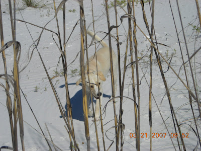

The Boy

We head across the island to the Gulf. There is absolutely no one in sight. We have the island to ourselves! Cool! Brilliant, sparkling, white sugar sand, the deep blues and greens of the Gulf, and a picture perfect clear blue sky to top it off! Spanky decides he’s had enough of this respect the nature stuff and starts bounding up the beach after some birds. The birds, as you would guess, fly away and land a few 100 feet down the beach. Spanky runs after them again. They fly down the beach. Spanky chases them again. This dog and bird polka goes on for quite a while till the lad wears himself out a little and develops a quite a thirst.


The Gulf of Mexico
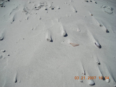
Undisturbed Shells on the Beach

We head back to the boat, guzzle down some water, choke down some sandwiches and relax for a while and then set off to explore the mangrove islands. For those of you unfamiliar with the Mangrove – a few facts. Mangroves are a species of tree that has totally adapted itself to high salinity, low oxygen, and tidal inundation. Mangroves thrive in a coastal tropical, subtropical environment. Their seeds actually germinate on the parent plant, drop into the water and float dormant (up to a year) until landing in a suitable spot to root. This is how mangrove islands start. A few mangroves root in a really shallow tidal area, over time more sediment builds up around the roots, more mangroves root, on and on until you have an island.

Mangroves Taking Root

These little islands are gorgeous! They create a perfect habitat for a plethora of our coastal feathered friends. The birds can hang out on these islands, relatively undisturbed, nest, feed on fish, and do whatever other bird stuff they do.


I See A Bird!


One of Our Feathered Friends

For the next several hours Spanky and I paddle amongst the islands. The kayak, ok – new fangled one man canoe, is the perfect conveyance for the task at hand. At times we are in only a few inches of water – there aren’t many boats other than a kayak that wouldn’t run aground. We explore little nooks and crannys in between the trees, constantly stumbling on to birds quietly sitting in the trees. Spanky is hunkered down in the bow just taking it in. I’m actually shocked at how calmly he sits in the kayak! I honestly thing the boy is a nature freak like me.


Cruising Through the Islands


Some of the islands have little waterways, natural tunnels under the thick mangrove canopy. We venture in to take a look. It’s really kind of a primordial setting. There’s just a little bit of sunlight filtering through the thick foliage, quiet except for the sound of the paddle dipping in the water and a few distant birds. I’m half expecting to have an anaconda drop out of a tree or to spy a pterodactyl clutching its prey.


A Tunnel Through The Mangroves

The Spankster and I spend a few hours on this little intra mangrove island odyssey. We thoroughly enjoyed it. By the time we made it back to shore me and Spanks were both pretty well cooked. Spanky from all the running on the island, me from hours of paddling.

So……..the next time you are in Florida, especially our neck of the woods, get a hold of a kayak or canoe, go out there and see some of the natural beauty that is available right at our fingertips. All it costs is a few bucks rental and a little bit of elbow grease.

A quick update: Spanky and I will be heading out of here on April 1st. Our initial plan of attack is Georgia, South and North Carolina (highest point east of the Mississippi) and Tennessee. From there we will head up the east coast for who knows how long. More to follow. Thanks for tuning in!
To view these and other pics of our kayaking adventure go to http://picasaweb.google.com/rkrevald/KayakingToShellIsland

Georgia – Brasstown Bald


Spanky Boy Scores Another Summit

A lot of people think that we are fools, crazy, whatever, going off on this 50 summit thing. So……..it is kind of appropriate that we took off from Florida for our next attack on the summits on April Fools’ Day!

Our first destination for this trip is Brasstown Bald, the top of Georgia. Brasstown is less than 100 miles from Atlanta. We figured that we’d spend the first night on the road somewhere in the Atlanta area. Not because it’s convenient, nope, because we have friends in Atlanta to freeload off of! Fortunately I got hold of one of my good pals from my consulting days, a dude named Matt Field, and me and the Spankster were able to crash at his pad. It was really nice to catch up (have not seen much of him in recent years), talk trash about nothing special, and pig out on Chinese food.

Which brings me to a very important benefit of this whole 50 summits extravaganza. Over the last few months since we started this nonsense, through trying to update my email addresses, phone numbers, etc I have managed to dig up a lot of old friends that I had lost touch with – pretty cool. Hopefully I’ll be able to introduce Spanks to most of these folks. Watch out, we may be in your neighborhood soon.

Did you ever wonder why Atlanta, one of the US’s biggest cities is there? I have (yep – I’m strange). Geographically, most major cities in the US where started as ports, on the ocean, on major rivers, or on the Great Lakes. So why Atlanta? The answer is railroads. Atlanta got it’s start as the “terminus” of the Western and Atlantic Railroad, which was built in the early 1800’s to provide a trade route to the Midwest. It became a key railroad hub during the Civil War and the rest, as the say, is history.

My buddy Matt had to get up at 4:30 am to catch a flight to DC. Spanky, being the consummate gentleman that he is, insisted that we should get up early, make some coffee, thank Matt for his hospitality, and wish him a safe and prosperous journey. Actually I couldn’t sleep – the excitement of an impending summit and all. Me and Spanks had a few coffees, did some route planning and off we headed for Brasstown.

Atlanta is a rush hour traffic nightmare. Luckily we were headed north east away from all that silliness. Spring in this part of Georgia is gorgeous! The leaves are coming out on all the trees, dogwoods and azaleas are blooming. The world is bright green and peppered in spectacular fashion with dogwood blooms. As you would guess, the farther from Atlanta we got, the more rural the setting. And………we start to encounter mountains! I’m such a dumbass, I really never realized that Georgia had mountains. The Appalachian Mountain Range extends into northeast Georgia – guess I just never bothered to pick up on that fact.

It didn’t take long and we were driving on twisty, narrow, deep in the woods, mountain roads. Did I mention that the weather sucked. As we started to gain elevation we got into clouds, drizzle, and mist. The cloud cover, however, was partially broken so patches of sunshine (sort of) broke through once in a while and we could actually enjoy the countryside. Up and down we went, probably averaging no better than 35 mph, occasionally hitting small valleys with quaint little farms and old houses. Finally we entered the Chattahoochee National Forest, home to Brasstown Bald – we were close.

Somewhere around 10 am we hit the access road to the mountain. There is a sign proclaiming “steep grade” and another saying “leave your trailer here” (not kidding). Signs are meant for other folks, not me and the Spankster. Mister smarty pants ended up doing about 15 – 20 mph, in second gear most of the way up. You think I’d learn – nope! We are obviously getting up high cause there is very little evidence of leaves on trees. Spring has not quite hit this high up.

In order to make the final summit approach we had to park the old truck and hike. It’s a pretty steep trail, .6 miles long, with a whole bunch of switchbacks. The trail is tunnel through a rhododendron forest. The rhodies are huge and the trees are small. Wind and weather conspire against the trees – they are gnarly and short. But the rock strewn, apparently reasonable moist conditions obviously provide a good home for the rhodies.

The top at last – Monday April 2, 2007! Brasstown Bald is 4,784 feet high. Not Everest but more than 2,000 feet higher than our previous record – Mount Magazine, Arkansas! It is named for the former Cherokee Village of Brasstown, GA. Supposedly on a clear day you can see Atlanta. Well…………this was no clear day. The summit, the observation tower, and the surrounding mountains were shrouded in clouds. We were able to take advantage of a few tiny breaks in the clouds to shoot some pics and to take in a rather awe inspiring view.

There were a few other crazies up there on this lousy morning. Spanky and I met a young couple from somewhere in Georgia (between Savannah and Augusta I think?) with two little girls who fell in love with Spanky. I told em all about what Spanks and I are up to and shamelessly handed them a business card promoting our website. Spanky vigorously wagged his tail to indicate his approval.

Wouldn’t you know, as we head back down the weather starts to break. Oh well, we nailed another one and that is what matters. We gingerly drove back down the access road (remember I’m towing the trailer that the sign told me not to tow), and headed off to look for our campground and home till Friday. A few weeks ago I found this place called Enota (after Enotah – the Native American name for the mountain) Campground on the net. It is only a few miles from Brasstown and we found it no problemo.

Enota Campground (I’ll write more extensively about it during the week) is a quite a find. Good fortune is definitely with us. The place is most excellonomous! It is tucked away in a thick forest, surrounded by mountains, with a burbling mountain brook running right through the middle of it. As a matter of fact, the brook/stream is right behind our trailer – I can hear it as I’m writing.

Spanky loves it here. He is quite a hit. Seems like half the kids in this place have already met him and know his name. There are a few really cool waterfalls within a short hike. Me and the Spankster hit one of em this afternoon. Spanky actually seemed to be mesmerized by the waterfall. He just sat at the pool at the bottom and stared at the cascading water. Yep, the little lad is a nature freak.

We’ll be doing South Carolina, Tennessee, and North Carolina during the rest of the week and update y'all when we can (I’ve got a wireless connection but it’s really lousy and fails most of the time). Thanks for tuning in.


Me and Spanks at the Top

A View From The Observation Deck

Another Mountain View

King of the Mountain

Our Home for the Week

The Stream Shimmering in the Sun

A Short Climb From the Campground - One of Many Waterfalls

Me and Spanks at the Waterfall

To view all our Brasstown Bald pics go to: http://picasaweb.google.com/rkrevald/BrasstownBald

Sign up for our distribution list

Just send us an email at rkrevald@gmail.com and request to be added to the Spanky and Rein distribution. We respect your privacy - all our emails are sent to a blind distribution, your email address will remain confidential.